
District Exploration Strategy
Till this time, the OKO property was always under exploitation and local level of exploration by the artisanal people. In the professional way, the whole area is yet to get explored. Guyana OKO Mining Inc. will take the following strategies into account with Exploration.
Non-Ground Disturbing Methods
Literature Search
Browsing the history of the land, studying reports and all available maps
Geological Mapping
Planning will begin with regional and local maps. This will allow for new maps that display vegetation and location of various rock types.
Geochemical Sampling
Sampling will allow for the locating of a particular mineral deposit by analysis of rocks, stream sediment soils, water, gas, or vegetation.
Geophysical Exploration
Exploration will allow to collect information about the physical properties of mineral deposits on the ground, or from the air (Remote Sensing) using drone technology.
Ground Disturbing Methods
Rotary Air Blast and Aircore Drilling
Used for drilling a small hole (less than 100mm) through soil and loose rock using a hammer, or blade bit, to drill the hole. This hole can then notify geologists if any minerals are present.
Reverse Circulation and Diamond Drilling
Similar to Aircore drilling, a deeper and larger hold (usually 140mm or larger) through undisturbed or deep rock using a hammer or blade bit, or an industrial diamond impregnated bit. This hole can notify geologists how much mineral is present.
All samples are then analyzed. If any mineral is present, the explorer will usually drill closer spaced holes to make:
Geological Models
Resource Models
Feasibility Studies
Digital Elevation Models
the Digital Elevation Model (DEM) of the regions indicates that OKO property is the extremely undulating with lots of small hillocks. The developmental stage in this area has to be in the phases and at the same time the exploration plan also need to be established based on the developmental stages. Initially idea of connecting 2/3 blocks with the major roads is proposed to replenish the exploration activity to identify the potential zones.
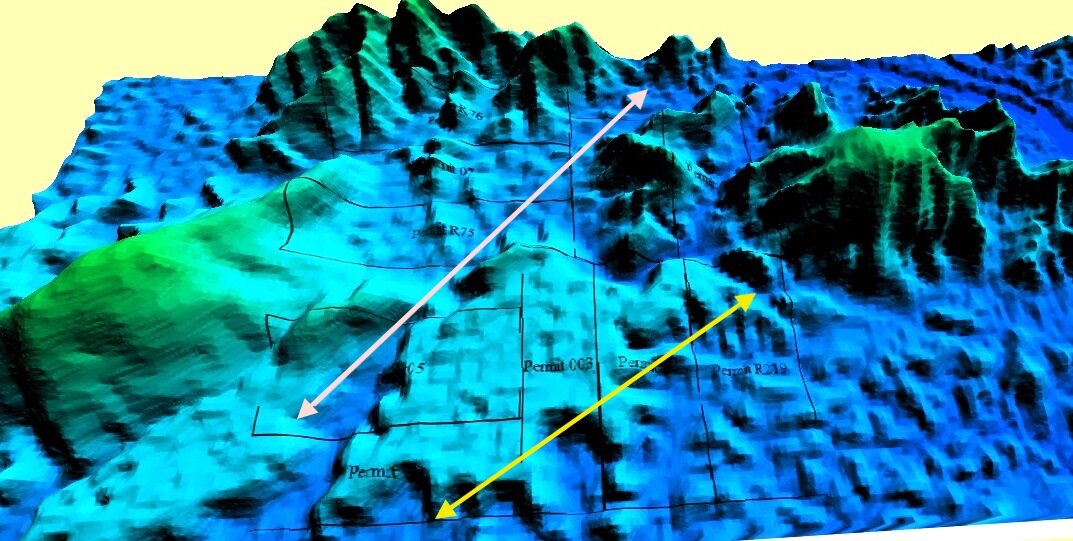
DEM of all the OKO properties showing major eroded dome structures, fringes (shown by the yellow arrows), valleys (shown by the arrow in pink), and the hillocks (undulating structures)

DEM model drape with 2m interval of contours